3.jpg)
Published January 12, 2024
A hard freeze will bring the coldest weather Houston has seen since 2022. Here's a timeline of impacts By Houston Chronicle

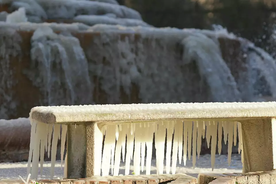

An arctic front is forecast to sweep through the Houston metro area this weekend and it’s expected to bring a hard freeze to most of Southeast Texas. Here is a timeline of when we expect temperatures to drop below freezing and when wind chills — winter’s version of “feels like” temperatures —could fall into the teens.
Sunday: Arctic front arrives
The well-advertised arctic front is forecast to come in much sooner than we initially thought earlier this week. Models often underestimate how intense and how quickly these types of fronts move, so the speedier arrival isn’t necessarily a surprise for local meteorologists. While the front arrives Sunday, the heart of the colder air doesn’t likely arrive until Monday and Tuesday.
TIME TO PREPARE: Why do pipes burst and how do I prevent them from freezing ahead of Texas' cold weather?
Nonetheless, if you’re preparing for the Chevron Houston Marathon that starts at 7 a.m. Sunday, you’ll want to prepare for temperatures in the lower 40s and wind chills in the mid-30s. Sunday afternoon will be cold, but not as cold as temperatures Monday or Tuesday. The chilly air will still be a shock to the system as temperatures fall into the upper 30s by late Sunday afternoon.
On top of this, wind chill temperatures will likely remain near to below freezing for most of the day as northerly winds kick in. Expect a sustained northerly wind of about 10 mph — something that will obviously affect how the human body feels Sunday afternoon.
Monday: Subfreezing temps start
Temperatures in Houston are expected to drop below freezing by early Monday with widespread morning lows falling to the upper 20s. Temperatures won't stay below freezing all day, as both Monday and Tuesday bring afternoon highs generally in the middle to upper 30s.
That’s a significant difference from the historic statewide February 2021 freeze, which brought subfreezing temperatures to Houston from Feb. 14-16. Despite this, a significant amount of time early next week will be spent flirting with freezing or below-freezing temperatures.
EXPLAINER: What is the polar vortex and how does it affect Texas weather? State climate expert explains
Wind chills, a crucial aspect of this arctic blast, are forecast to drop into the teens for most of Southeast Texas, especially from Houston northward. Even south of Houston, wind chills near 20 degrees aren’t exactly a walk in the park.
For Houston’s Martin Luther King Jr. parade, which kicks off at 10 a.m. Monday, wind chills are expected to be just a hair above 20 degrees. If you are planning on attending the various holiday events taking place outdoors, dress in layers to keep the chill at bay. Wind chills Monday afternoon will generally remain in the mid-20s, with mostly cloudy skies adding an extra layer of chill.
Tuesday: Longer period below freezing
Monday’s forecast depicts below-freezing temperatures for roughly 12 hours, while Tuesday is likely to see a longer period of subfreezing weather. Forecast guidance for Houston depicts temperatures below 32 degrees by 8 p.m. Monday, with morning lows early Tuesday as cold as 21 or 22 degrees.
Temperatures, which could drop into the upper teens in Harris County, away from the influence of the urban heat island, aren’t likely to get above freezing until the afternoon. That means Houston will endure subfreezing air temperatures for about 16 to 18 hours.

This map shows forecast wind chills for Monday morning, according to the National Blend of Models. Temperatures are likely to feel like they are in the 30s as the Martin Luther King Jr. Day parade kicks off in Houston at 10 a.m.
WeatherBELLTuesday morning is likely to be the coldest early next week. Wind chills as gusty northerly winds crank up will likely drop into the single digits and teens. To reiterate, wind chills as you walk out the door Tuesday morning for work or school will generally range from 6 to 14 degrees. Afternoon wind chills Tuesday will be similar to Monday, with most spots topping out at between 23 and 27 degrees.
WEATHER LINGO: What is a 'hard freeze' in Texas, and how is it different from a regular freeze or frost?
By early Wednesday morning, wind chills are expected to bottom out in the mid-teens for most areas of Southeast Texas. Luckily, wind chills will gradually warm into the upper 30s by midday Wednesday.

This map shows forecast wind chills for Tuesday morning, according to the National Blend of Models. Temperatures are likely to feel like they are in the single digits in and around Harris County, with subzero wind chills possible closer to College Station and Bryan.
WeatherBELLBottom line
Temperatures will be coldest from Sunday night into Tuesday morning, with nearly 28 hours of total time spent below freezing. Unlike the February 2021 freeze that crippled infrastructure across much of the Lone Star State, including in Houston, temperatures are not forecast to be subfreezing for the entire duration of this weather event.
"Call Eli Torres at (832) 430-2107, for your home buying and selling needs."
Source: www.houstonchronicle.com
